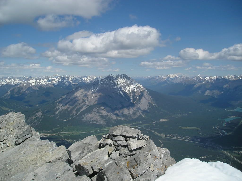
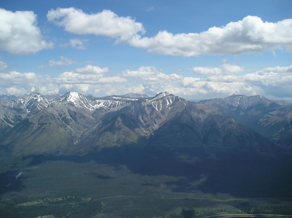
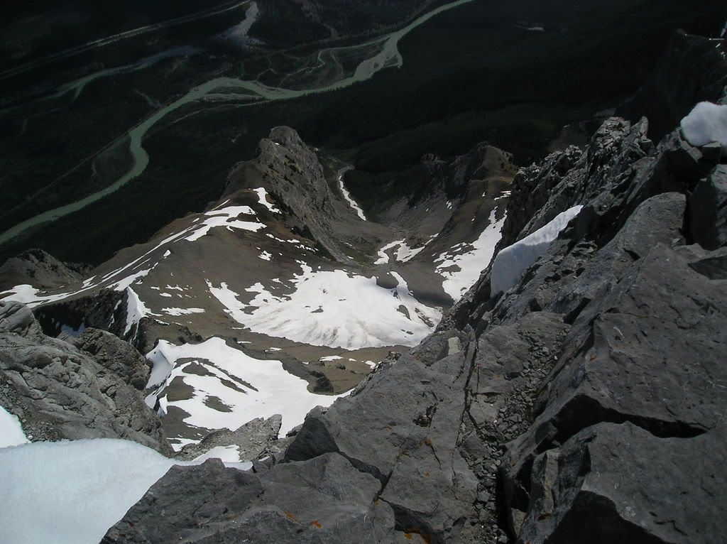
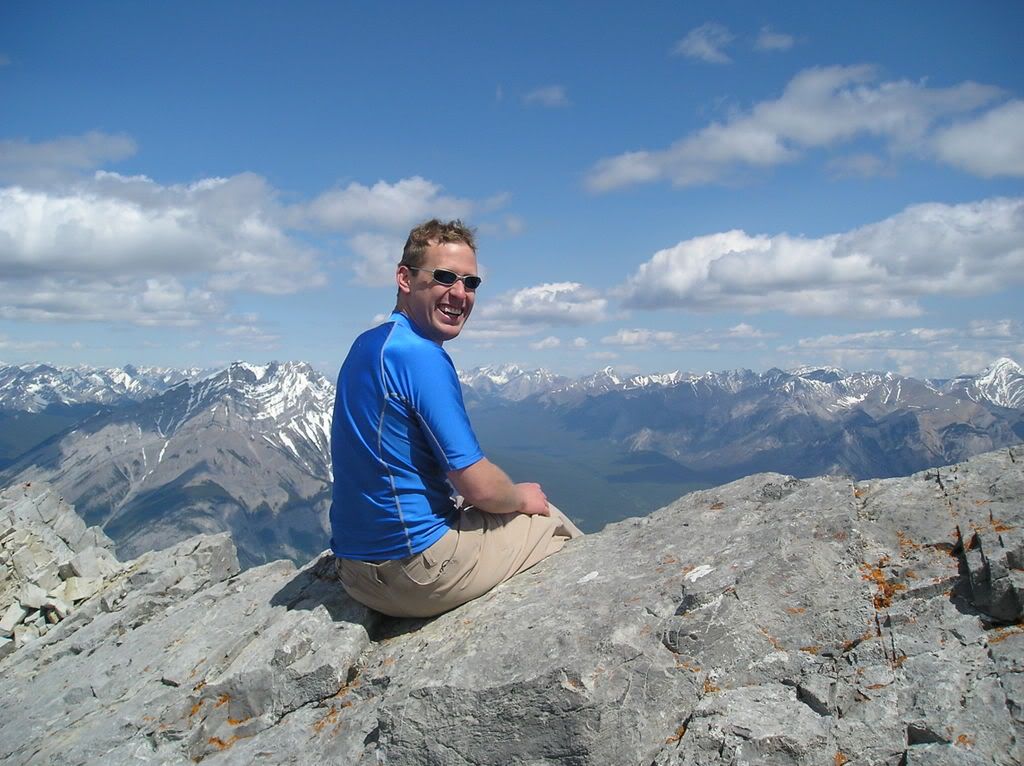
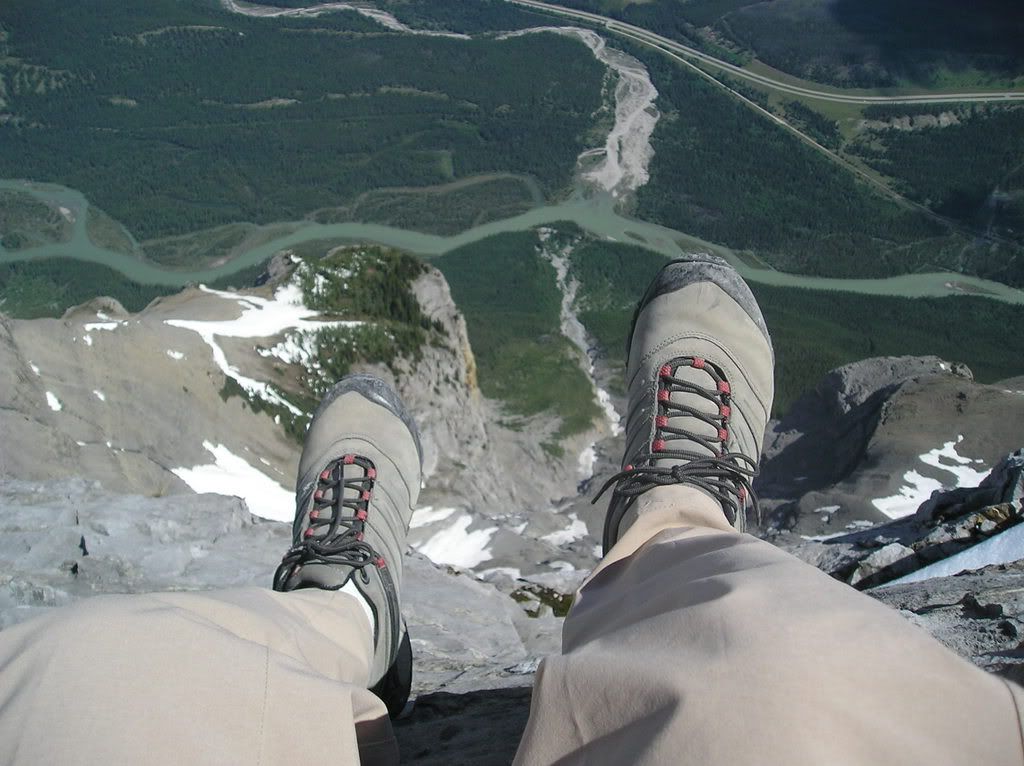
Wednesday, June 27, 2007

'Lost' Ramblings

Bonnie and I just had our "weekend" that foolishly lies on monday and tuesday. Monday was one of those days that is really "neither here nor there" in terms of weather, and we wallowed it away in front of the TV, successfully watching probably the first 17 or 18 episodes of "Lost". We also successfully ate chocolate fondue, made a huge mess of the kitchen, and moved from the couch at least 3 times. Maybe 4.

Was a good day!!

I'm not usually one to talk about television, but "Lost" is good TV. Epsecially with no commericals and when you don't have to wait for the next episode. Rock on!

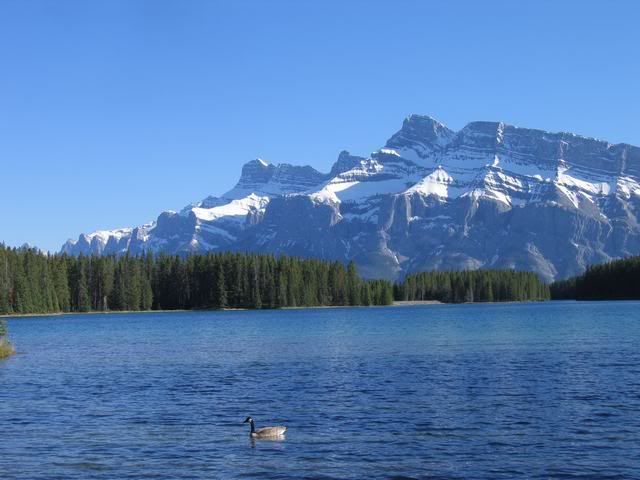
Today was exceptionally warm (as was yesterday, actually), and when I was walking to work I noticed something odd. Usually in spring/summer, you get those little white tree seed, pollen, floaties lazily drifting by all the time. I'm used to this. What I thought was incredible was the amount of them out here. It really gave some idea of what snow in 25-degree heat would look/feel like. I took a few pictures in an attempt to capture just how much was flying around, and this is the best one. That car means nothing. It's black. And owned by somebody I don't know. Hopefully the person driving it.

Photo Sharing and Video Hosting at Photobucket

Yes. The picture is big. There are 2 reasons for this

#1 - I like it big. You don't have to open them in a new window to see all the detail. You should like it this size too

#2 - I don't know how to resize them and, while I suaully seek out new knowledge, this particularly bit of technical know-ho does not seem to be one that I am motivated to discover. Perhaps it has something to do with reason #1. So stuff it Jontan. When we got that divorce I meant it. You're not the boss of me anymore.

Anyway....


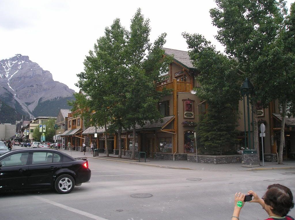
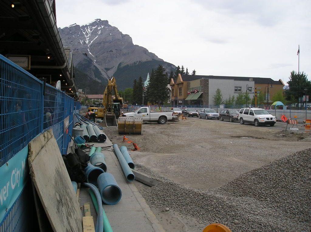
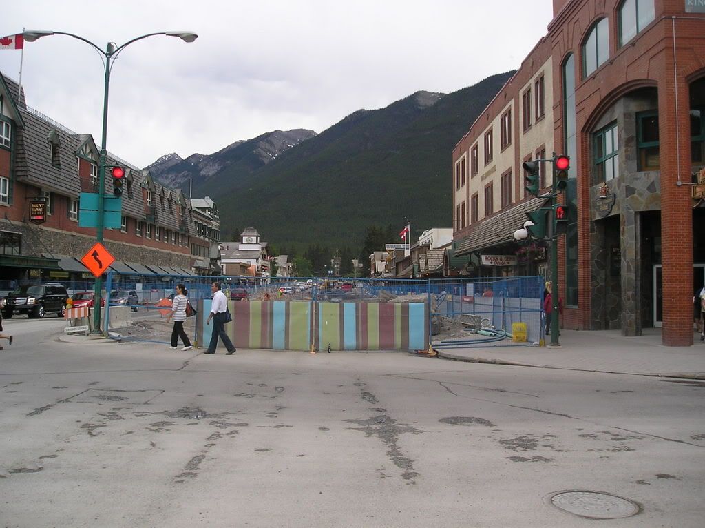
I've referenced the construction in town a few times now. Today I took some pictures. It's a pretty big deal around here and my work has been shaking on-and-off for at least a month now. Today they were doing some....banging...i guess...right outside the door here and I got so irritated with the noise I went up and closed it.

I'm also going to be sending some of you lucky folks some genuine "Banff Refreshing" squirrel buttons! Yes! We have buttons!! The town is giving them away to people for free as one of their many prorgrams to make Banff more cozy during the construction. Consider yourself extra-special if you score the McStiffy button! There are 5 to choose from so not everybody can be so lucky, unfortunately.


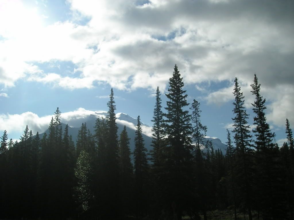
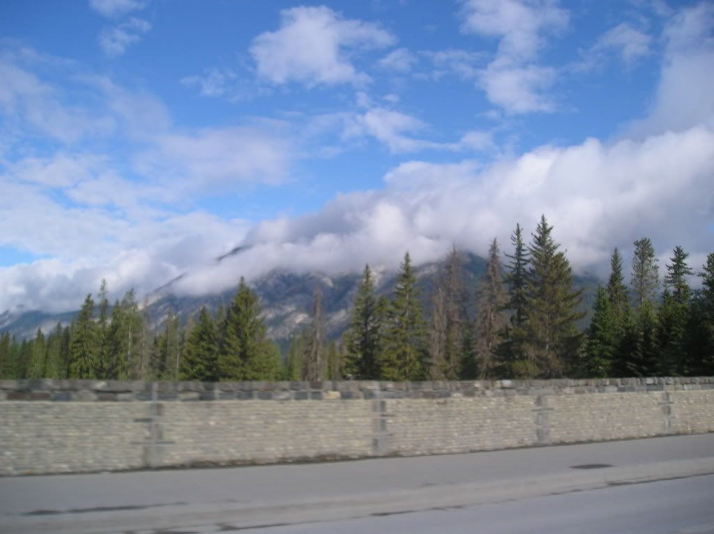
In any case, here is a picture taken each way from the main intersection in town. We're very close to them completely closing off this road. That should be even more fun!!!


Photo Sharing and Video Hosting at Photobucket


Photo Sharing and Video Hosting at Photobucket

Saturday, June 23, 2007

Biggest Hike Yet ("climb" by some definitions)

So!

Today was the day. Up Mount Rundle. Wowee... First, let's see if I can dig up a shot of this beast; I'm sure i've taken one at some point....

This one will do! It's an oldy, but a good-y!! Rundle is the one on the left

Photo Sharing and Video Hosting at Photobucket

Let's see. Some stuff about Mt Rundle (talk about edutainment! This blog offers everything)

Elevation: 2950m (ooo!)

Mount Rundle is 12km long! Zomg! And has many "peaks" along the way

It's quite famous amongst Mountain Photographers (for obvious reasons) and geologists. The geologist part is actually pretty interesting:

You can quite easily see how the mountain was pushed up despite erosion (that has
changed many other mountains in the area that wer ebuilt the same way)

The rock on top is older than the rock on the bottom. Wrap your head around that one.

Anyway, before I say anything to the contrary, we didn't actually make it to the true summit. Like I said, there are many "summits" of the mountain and we made it the 2nd highest one. The highest is inaccessible without climbing gear. Man...gotta go back up there and build a huge cairn on top of our summt to fix that. Now THAT is a mission.

Anyway there were 4 of us set to go. One bailed and another called in sick to work..er...hike. So Tom and i went out. We hit the trailhead at 7:30 and were greeted by 6km of forested path, usually gently sloping but occasionaly some steeper switchbacks. The forest was nice, the bugs weren't so nice, adn the views weren't that much for a while. However, what was interesting was the continuing change in vegetation from very lush to very rocky.

Here's Tom. Otherwise this picture is pretty random

Photo Sharing and Video Hosting at Photobucket

And a picture of the mountain across from us - Sulphur. Occasionally the trees would break like this and we'd get a view. They never broke up the mountain though, so we never really knew where we were or how far away from the summit we were.

Photo Sharing and Video Hosting at Photobucket


Finally we got through "Part 1" (re: the easy part) of the hike and arrived at this gully. It gave us the first view of just how far we had to go. WE were dismayed. I checked our guidebook and they quoted that we were fortunate enough to STILL have 1125m in vertical-gain only to go. we were not impressed. But pressed on, persevered, and continued. And we kept going.

Photo Sharing and Video Hosting at Photobucket


So the rest of the climb was...fun. Yea....fun. To say the route was steep would be like saying that mom's brand of stupid-food is "ok". It was also quite long. YOu can get a sense of the steep-ness in most of the shots.


The slope at the start

Photo Sharing and Video Hosting at Photobucket


Long way up from that gully already. It hasn't gotten any easier

Photo Sharing and Video Hosting at Photobucket


And our 1st break (same spot as the last 2 photos). Had some food here and a well-deserved rest. The slope is just unrelenting.

Photo Sharing and Video Hosting at Photobucket


One of the more (or possibly only) interesting portions of the hike was this section over what's called "Dragon's Back". The pictures should explain why. The cliffs on each side were pretty big and the rock was fairly slippery because of all the loose pebbles on it. Exciting!!! Makes a good adrenaline-sport out of walking at .5 mph :p


Photo Sharing and Video Hosting at Photobucket


Photo Sharing and Video Hosting at Photobucket


Photo Sharing and Video Hosting at Photobucket

Photo Sharing and Video Hosting at Photobucket

Photo Sharing and Video Hosting at Photobucket


No that last one i'm not outer space, but it's a cool camera effect!! Can't figure out how it happened.


So next up are a bunch of pictures taken from the summit. Definitely went 360-degrees up there. Was tough because it was FREEZING cold and the wind was nuts. I unfortunately failed in my role as king-gadget and left my uber-swiss army knife at home, so I was unable to get a temperature reading. But we figure somewhere between 2 and 4 degrees is accurate. Then there was an increidble amount of wind. It's a good thing that somebody was good enough to build a fort!! Alas, no verifiable evidence exists of my defending of said fort because I was on break


Photo Sharing and Video Hosting at Photobucket


Tom up at the summit. ooo story...

So we're going up...and up...and up...and you get towards the top and you are walking right along the ridge...


Photo Sharing and Video Hosting at Photobucket


Photo Sharing and Video Hosting at Photobucket


And it's cool and somewhat scary and colder than blazes and we're exhausted and going "awesome! we're almost to the top!!!!!". So we turn 90-degrees and continue along the ridge (now the main, 12k ridge that runs the length of the mountain) and get to the summit and discover it's not, in fact, the top, and that we have to scramble another few minutes. *sigh*. Anywhere, here's tom at the highest accessible point


Photo Sharing and Video Hosting at Photobucket


ANd some views of the summit from below. Man these pictures were disheartening. The "first" summit i talked about is on the left. The highest one we could get to is the one on the right (they both just look like little rock outcrops from here)


Photo Sharing and Video Hosting at Photobucket


Photo Sharing and Video Hosting at Photobucket


I was the first up to that high point by about 5 minutes or so and definitely stood there, threw my hands in the air and let out a huge roar. over 4 hours of steep, relentless hiking in progressively more adverse conditions. TOday's hike was one of the most physically demanding things I've ever done, but the accomplishment and the following views made it worth every step.


The peak closest to Banff. Not quite at the top here yet; at the top this looked so small

Photo Sharing and Video Hosting at Photobucket


South to the sundance range

Photo Sharing and Video Hosting at Photobucket


Southeast to Mt Assiniboine (the extremely tall one covered by clouds). Alas, you can't climb that mountain without a great deal of mountaineering experience, tons of gear, several days, and a good deal of weather-luck.

Photo Sharing and Video Hosting at Photobucket

From the fort. Same direction. Definitely worth defending. Keep that swarm of tourists that we passed when we were going down. It's bad enough that they fill the town up and make me not want to come to town - they have to fill the mountain up too!

Photo Sharing and Video Hosting at Photobucket

Down the slope. That's a lot of scree!!! (our route is 2 cliffs to the right)
Photo Sharing and Video Hosting at Photobucket

Northeast through the Bow Valley to Canmore (and, on a clearer day, Calgary)
Photo Sharing and Video Hosting at Photobucket

West over town to the Sawback Range (and a ski area)
Photo Sharing and Video Hosting at Photobucket

Normally Cascade looks so big... (northwest)
Photo Sharing and Video Hosting at Photobucket

Across the Bow Valley (North)
Photo Sharing and Video Hosting at Photobucket

The North Face of Rundle is..well...cliffs. So here's a picture of that.
Photo Sharing and Video Hosting at Photobucket

And a few pictures to sum up the rest of the trip. First, Tom being smart
Photo Sharing and Video Hosting at Photobucket

Second, me being...less smart
Photo Sharing and Video Hosting at Photobucket

And thirdly - what is quickly becoming a tradition
Photo Sharing and Video Hosting at Photobucket


Finally, to soothe you from the last few pictures, something I shot while walking to work today afterwards. It's Cascade and the Bow River (which is still quite high)
Photo Sharing and Video Hosting at Photobucket

Wednesday, June 20, 2007

Life is continuing on pretty much the same way as it has for the last while. Finishing up my paperwork for the driving job and that should get going next week sometime. Yesterday I had a physical done and I'm healthy!! Not only that, but my blood pressure finally tested normal. Those little contraptions normally seem to stress me out. So "huzzah!" to that.

Yesterday Tracey and I went on scramble up a little (relatively speaking, of course) rock tower called "Tower of Babel". Creative..

Photo Sharing and Video Hosting at Photobucket

Anywho, it was a great little day. Only about 1.5hours up and very fast down. The hike was quite steep and almost entirely scree slope. (Scree is the kind of slope that seems to be endless swathes of loose rock over avalanche slope. 2 feet up, 1 foot down with each step. Of course, going down is 2 feet extra for every step, so it balances out). Here's a picture of our route. It's more of a gully than a slope really, but you get the picture. Towards the top things got a little more interesting.

Photo Sharing and Video Hosting at Photobucket

Photo Sharing and Video Hosting at Photobucket

On top we were greeted with a large flat table and 360-degree views of the mountains in the Lake Louise area. The most spectacular direction was the Valley of 10 Peaks which was the subject of the backside of the old $20 Canadian Bill (check it out!) Here's what it looks like in techni-color, instead of that dreary green. This is actually (more or less) the same picture as was on the bill I think.

Photo Sharing and Video Hosting at Photobucket

And a bunch of pictures of the view from the summit. First Moiraine Lake from up top (and no, there is no color modification in these photos). I guess it's largely subjective, but I don't see how anybody can think that Lake Lousie and its area of Mt Victoria etc is prettier than Moirane and the Valley of 10 Peaks. Guess the notoriety of Louise gives it that edge.

Photo Sharing and Video Hosting at Photobucket

So here's us just out of the gulley. Feels a little colder :p

Photo Sharing and Video Hosting at Photobucket

And at the top in this keen fort somebody left behind!!!

Photo Sharing and Video Hosting at Photobucket

As we later discoved, that "fort" was actually this couch. There was also a "coffee table" and two "chairs" built up there by some group of hikers. All the comforts of home!!!

Photo Sharing and Video Hosting at Photobucket

And let the 360degree view begin. This one is off back towards the Bow Valley. You can see Lake Louise ski area in the back left side and me sitting down at the edge.

Photo Sharing and Video Hosting at Photobucket

One of the biggest mountains in the Canadian Rockies : Mout Temple. It's snow-covered year-round. The picture doesn't really capture just how big the mountain is not only in height, but in overall size.

Photo Sharing and Video Hosting at Photobucket

The valley opposite to Moiraine Lake. That lake down there is still frozen!!

Photo Sharing and Video Hosting at Photobucket

Heh. And finally some photos of us being dumb. Talk about vertigo! It was pretty overwhelming sitting on the edge, looking out over all that forest. The only man-made thing visible from there was the small road leading into the lake. Otherwise nothing but mountains, forests, and other lakes. And still enough to hear the roar of a stream 1000m below.

Photo Sharing and Video Hosting at Photobucket

Photo Sharing and Video Hosting at Photobucket

Photo Sharing and Video Hosting at Photobucket

Thursday, June 07, 2007

Well it's been a week since I got the LASIK done and man...this is so cool. It's still sinking in that I'm not actually wearing glasses and am still constantly forgetting that I don't actually need to take my contacts out, or that I my glasses aren't sitting on my face, or that I didn't actually sleep in my contacts. It may be a bit early still, but I'd definitely recommend the surgery to pretty well anybody not only as convenient and liberating, but also as economical in the long run.

In other news it's my last day at Tony Roma's on Sunday. 75-80hour work weeks caught up to me and I was just constantly frustrated at my lack of free time. I chose to stay at the internet cafe full time instead of Tony's entirely because of wage and financial considerations: when I get paid the same amount to blog at a job with predicatble and fully flexible schedule, why would I choose the other one? I've really enjoyed my time in both places (as much as one can enjoy work) and felt that I've grown fairly strong in my position at Tony's. It's also been rather vindicating that a large number of staff have expressed regret to me that I'm leaving. AH well...business is business.

In replacement, I've picked up (and am still setting up because of conflicting schedules and eye surgeries) a driving job -- mostly to the airport and back. It promises to pay me the same as (if not more than) Tony's at a drastic reduction in hours. Looking forward to getting that off the ground.

In other news it's fully summer out here (nevermind yesterday's snowfall on the mountains) and we seem to have completely skipped spring over. The unusually warm weather in combination with the unusually large snow-dump on the mountaintops have combined to create some pretty awesome river swells and flooding in parts of town here and to a much greater extent in Calgary. Things weren't helped by the large amount of rain we've had lately (including the construction through town, which I'll chat about in a second).

Anyway here are some pics for you. They're from a morning walk to work a while ago as well as a stop I made yesterday to the Bow Falls to see it for myself. With the river as high as it was (flooding parts of town, like i said), i had to check out the falls for myself. For comparison, check how they looked back in October (i took some pics and posted them very early on in my blog here). The ones with the Lake and Mount Rundle were taken by Tracey and Dave.

Photo Sharing and Video Hosting at Photobucket

Photo Sharing and Video Hosting at Photobucket

Photo Sharing and Video Hosting at Photobucket

Photo Sharing and Video Hosting at Photobucket

Photo Sharing and Video Hosting at Photobucket

Photo Sharing and Video Hosting at Photobucket

Photo Sharing and Video Hosting at Photobucket

Photo Sharing and Video Hosting at Photobucket

Photo Sharing and Video Hosting at Photobucket


So I mentioned construction...

The main street of town and the cross-streets for it are under construction for the entire summer. They are re-doing everything: pipes, road service, wiring, sidewalks, seating along the road, plants...everything. And yes, I said the entire summer. How great is this?

The bumping in the street has caused a pipe in the restuarants upstairs to break. Guess where the water goes everytime they use a sink? Oh yea...get to empty our buckets every hour or so at work here. I also like the dust and, even better because of all the rain, al the mud that is our main roadway. I'm actually almost looking forward to when they just close the entire street off (you can still drive on one side only) because it means that cars won't be throwing dust down the stairs into the iCafe anymore :p

As beauitful as I'm sure it will be when it's done, it's too bad that the summer that I'm out here the whole downtown area is something of an eyesore. Ah well...like i said -- will be great when it's done. Maybe I'll post some pictures of it to balance all the pretty ones I put up.